Day 5. June 19, 2010
Wow. We are now actually into day 8, June 22. We have had fantastic visits to Arches, Canyonlands, and now Bryce Canyon National Park. So, with Cindy’s very useful diary, and pictures, we’ll play “catch-up”, starting with day 5, which was departure day from Provo. Will also scan in some of Cindy’s watercolors, time permitting. (Actually, I’m playing “catch-up” by working backwards. Did day 9 first. Sorry that days 5-8 are still in outline form only, but.... we march on!)
Depart Provo about 8:50am.
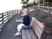
Cindy sketch soldier summit US 6.
MP-228 balanced rock Price Canyon
MP 300 US 6 intercepts w/I 70
Arrived Moab about 1:00pm walked streets of Moab, went by slickrock café. Cindy remembered that we ate there on our last trip to Moab, some years ago, and has a ball cap from there.! Grocery run, Riteaid, and then an afternoon trip to Arches. Went to visitors center, and then to the lower part of Arches, including Park Avenue.
Camped at __________________________ Reasonably good facilities (booked for three nights)
Day 6 June 20, 2010
Day tour of Arches. Went past Park Avenue and continued north on park road. Delicate Arch, Fiery Furnace, Windows, Tunnel Arch (near Pine Tree Arch), north end, but passed on Landscape Arch. Went past a picnic area where we had picnicked years ago. Checked out RV campground. Quite good, no hookups tho, reservations required. Pooped by about 3:30pm.
Day 7 June 21, 2010
Spend the day touring Canyonlands. Great to revisit. Check map and pictures for details. Several overlooks. Included Mesa Arch, which we had seen and remembered clearly from years before—Cindy because we had sketched it and I because of photo. It’s also the arch scene that is included in Windows 7. Weird arch. On the near side, there is solid rock, but one step too far and it is a 500ft drop.
On way back from Canyonlands, we took a side trip on route ???? along the Colorado River and saw some petroglyphs. Returned to campground for the evening after a grocery run.
Day 8 June 22, 2010
Left Moab about 8:30am for Bryce Canyon. Arrived Bryce around 3:00pm and stayed at Ruby’s RV Park and Campground, part of a complex for tourists to Bryce. Really quite good. Took Shuttle to Visitors Center and to Bryce Point. Evening at campground—grilled.
Day 9 June 23, 2010
Today started out very well. We did laundry and then we used the Shuttle bus system from our RV site (Ruby’s RV and Campsite) into the park. We went to “Inspiration Point” and spent about 20 minutes there. It overlooks the same amphitheater as yesterday’s visit to “Bryce Point”, only further to the north. In fact, we could look south and see where we had been yesterday. (Insert photos and Cindy sketches). We then used the shuttle to get to “Sunset Point”. More pictures, more sketch work, and then we walked to the Bryce Lodge. Debated having lunch at the Lodge, but meals were heavy duty. So, we walked back to Sunset Point knowing there was a ranger lecture scheduled to start at 11:30am.
The 30 minute lecture, at the rim of the canyon overlooking hoodoos, was excellent. The ranger explained the five main sections of the Grand Staircase, going from the Grand Canyon through Canyonlands. If I have it straight, the five are: Grand Canyon, Vermillion Cliffs, Grand Staircase (itself), Bryce Canyon, and Canyonlands. Mostly sandstone, old inland sea (at one point in geologic history there was a sea separating eastern and western United States. Ultimately there was an movement north of the North American Plate, and an uplifting and drying out of the sea. Apparently two major forces at work over the last 280 million years. A five thousand foot uplifting, and a crumpling of the North American Plate. I’ll need to work on this, but it was a very fine 30 minute talk, with about 50 visitors listening. Suspect it gets repetitive for the Ranger, but it was interesting to us.
We then started to walk to the General Store, to see if there was food there, and went about a third of the way by foot. Finding a shuttle back at the Lodge, we took it gratefully and went to the Sunrise area, which includes the general store. Partial success on food. Found enough food to keep going. We then decided to take the shuttle back to the RV site and rest. But, we stopped by the park visitors center and watched a 25 minute video presentation (read movie) on Bryce Canyon and its environment.
We learned something today. There is something to this condition called altitude sickness. Bryce Canyon ranges from about 7,700ft to 8,300ft in elevation. We wondered why we were so tired. I didn’t really understand it until I snapped out of it tonight, and Cindy also looked back over the last several days, realized she too was dealing with it. At any rate, after a short nap, we walked to Ruby’s Inn.
Fascinating commercial establishment dating back to about 1919. We really enjoyed the shops, hotel lounge and “old west-style stores across the highway, but once again opted for ice cream instead of dinner at the lodge. We’d eat at the RV. Got back to the RV and enjoyed a relaxing, quiet evening, observing the comings and goings in the park. Lots of young families! Wonderful opportunity for them.
Day 10 June 24, 2010
Today’s planned travel distance is short, 114 miles to Kaibab Camper Village at Jacob Lake, Arizona. So, we started by going back into Bryce to go further south on the park road than the shuttles go. This got us to Farview Point and to Natural Arch.


We then had a late--12:00noon (11:00am) our time-- breakfast at Ruby’s Inn, fueled up, and headed on to Jacob City. (We went west on 12 and then South on 89.
Red rock canyon and Forestry Service Visitors center. Comment on, and put in pix.
Road construction leading to Zion-good thing Zion was not on this trip plan.
Wildlife Rescue site. Pic of sign, and info about the site.
Side trip to Pipe Springs National Monument (abt 28miles RT), just into Arizona west off of US 89. Fascinating spot. Add pictures and description. On reservation. Early Mormon Settlers named Winsor built “Winsor Castle” over the spring. Took a really interesting guided tour of the site. Add description and pix.
Arrived Jacob City about 5:30pm (4:30pm local).
Campground ok, good site for us. Full hookups,
Day 11 June 25, 2010
We got a reasonable start from Kaibab Camper Village (Jacob City), and headed to the North Rim of the Grand Canyon. We continued driving through the Kaibab National Forest. Saw one extensive fire result, and learned later that a microburst four years ago significantly expanded a lightning-caused fire. The trees were dead and showed the effects of a fire that had crowned. The park entrance was about 12 miles from the North Rim, and once we entered the park, saw a deer, and a herd of bison. Wildlife hasn’t been plentiful this trip, partly because we’ve been travelling in the heat of the days. The day started out cloudy. First cloudy day since leaving the northwest area.
We have had a GREAT visit at the North Rim. We arrived before noon. We checked out the lookouts in the immediate vicinity of the lodge, and checked to see if our cabin was ready. By going to the desk early, we got to pick our cabin (340) and then wait for it to be cleaned.


Outer cabin, looking east, just above the trail. Really like it. Had lunch at the Grand Canyon Lodge, checked status of cabin, and found it was ready early. Got our luggage, plus, from RV to cabin, and made it to a 3:00pm geology presentation by one of the rangers.
The presentation was to be on the porch next to the sun room at the lodge, but thunderstorms (!) caused the Ranger to move his presentation to the large recreation hall.


The Ranger did a really nice job, and thundershowers continued throughout his presentation. He pointed out that lightning is a danger in these areas, especially along the rims. Saw a spectacular bolt about 2,000 ft away. Good we were inside! After the lecture (and the thunderstorms!), we went to deli to pick up salads for dinner.
About 6:00pm, the thunderstorms had mostly passed, so we hiked the trail to Bright Angel Point. Not long, but with some grade change, and unbelievable drops along the side. Beautiful views of the canyon.


Trail from our cabin to Bright Angel Point
Went back by the Lodge, enjoyed the activity there, and then went back to our cabin to enjoy ice cream while we sat in rockers on our porch.


Our plan is to get a very early start in the morning, as we have a 391mile drive tomorrow! Longest so far this trip. Our stay at the North Rim has proved to be everything we wanted, and more. But, like most places we visit, we always have more to do next time.
Well, I just had a diversion. It’s about 8:30pm our time, and as I was coming back from the RV (picking things up), I saw a full moon rising in the east! So, another walk, and about 30 minutes later, I got back to the room.

Enough for one day! (These are the only clouds left after the thunderstorms!)
Cindy and I got up before sunrise! (on our departure day, June 26. We saw the sun come up, and prepared to head on to Santa Fe via Gallup. But, as a lasting treat from the North Rim, here’s the sunrise.

And a final look at our cabin in the morning sun.